
Fichier:Brazil State Tocantins.svg

Original Fichier (SVG-Fichier, Basisgréisst: 702 × 687 Pixel, Gréisst vum Fichier: 676 KB)

|
Standardization of derivative maps
Feel free to create derivations of this work, but if you want to illustrate a Wikipedia article with derivative works of this or similar maps of Brazil, please strictly follow the visual standard, nomenclature and classification already in use. All maps of Brazilian subdivisions are being adaptated or created in this way. We do not want to inhibit creativity but the pattern adopted here was presented and accepted by the Lusophone community and should be followed whenever possible. |
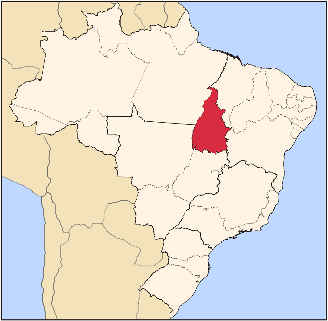
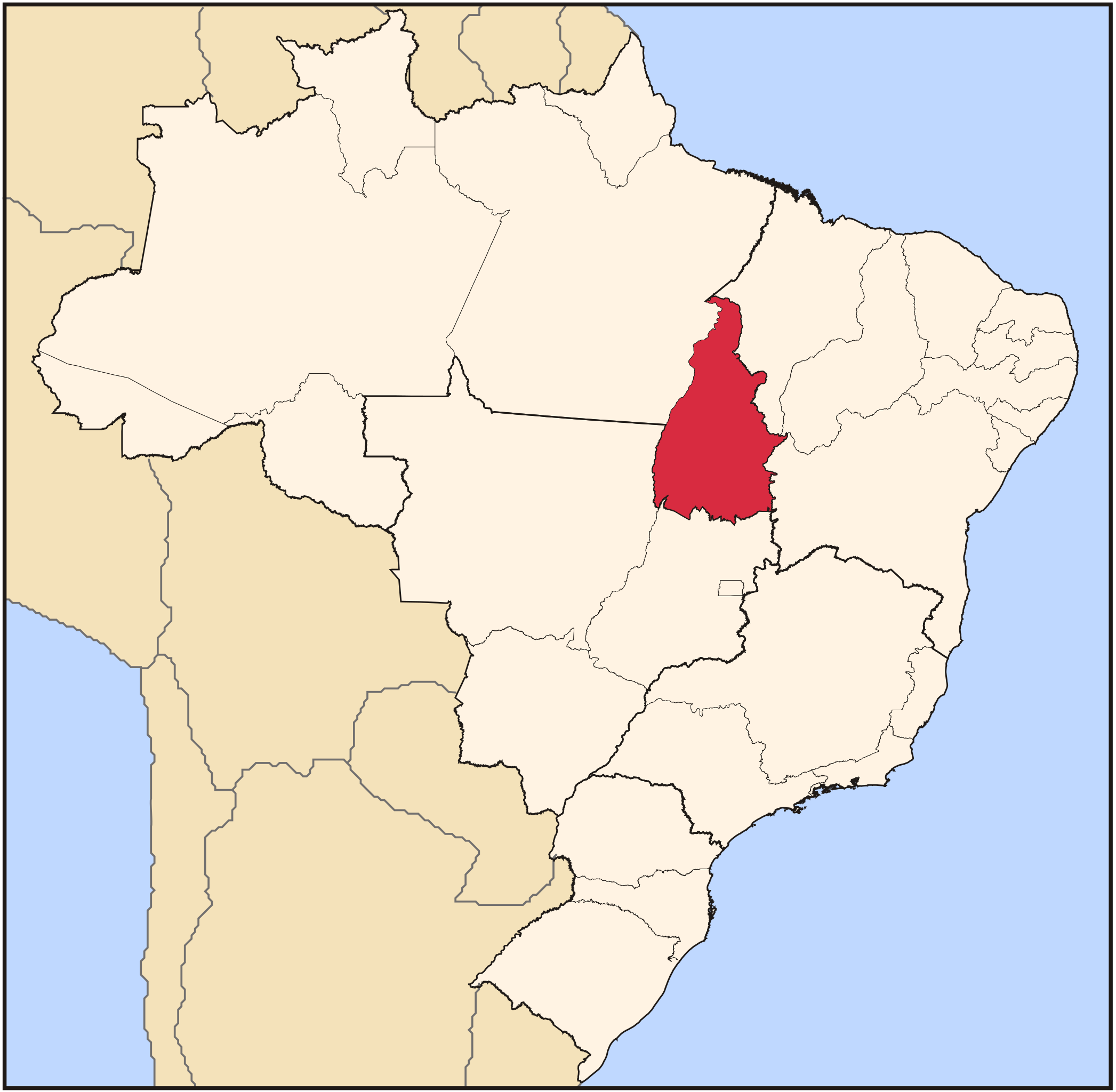
| Beschreiwung | Map locator of Brazil's Tocantins state | ||||||||
| Datum | |||||||||
| Quell | Eegent Wierk | ||||||||
| Auteur | Raphael Lorenzeto de Abreu | ||||||||
| Autorisatioun (Dëse Fichier nach eng Kéier benotzen) |
Ech, deen deen d'Auteursrechter vun dësem Wierk huet, verëffentlechen et heimat ënner dëse Lizenzen:
Dëse Fichier ass ënner der Creative Commons Attribution 2.5 Generic Lizenz disponibel.
Dir kënnt d'Lizenz vun Ärer Wiel eraussichen. |

Versiounen
Klickt op e bestëmmten Zäitpunkt fir déi respektiv Versioun vum Fichier ze kucken.
| Versioun vum | Miniaturbild | Dimensiounen | Benotzer | Bemierkung | |
|---|---|---|---|---|---|
| aktuell | 03:18, 3. Jun. 2006 | | 702 × 687 (676 KB) | Raphael.lorenzeto | |
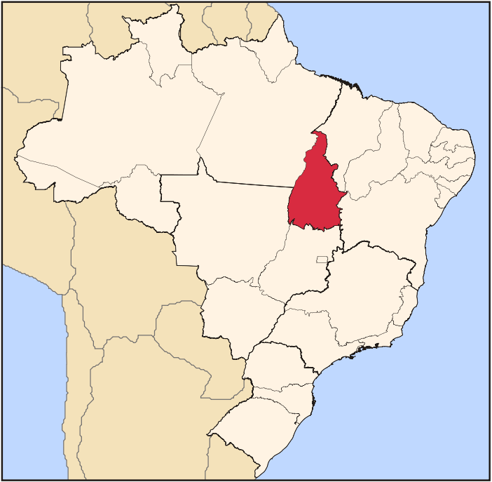
| 02:16, 22. Abr. 2006 |  | 702 × 687 (448 KB) | Raphael.lorenzeto | {{Information| |Description=Map locator of Brazil's Tocantins state |Source=own work |Date=April, 21 2006 |Author=Raphael Lorenzeto de Abreu |Permission={{self2|GFDL|cc-by-2.5}} |other_versions= }} Category:Maps of Brazil |
Benotze vu Fichieren
Dës Säit benotzt dëse Fichier:
Globaalt Benotze vum Fichier
Dës aner Wikie benotzen dëse Fichier:
- Benotzt op af.wikipedia.org
- Benotzt op arz.wikipedia.org
- Benotzt op bg.wikipedia.org
- Benotzt op bpy.wikipedia.org
- Benotzt op da.wikipedia.org
- Benotzt op de.wikipedia.org
- Benotzt op dz.wikipedia.org
- Benotzt op en.wikipedia.org
- Tocantins
- Natividade, Tocantins
- Palmas, Tocantins
- Araguaína
- Paranã
- List of municipalities in Tocantins
- Porto Nacional
- Almas, Tocantins
- Alvorada, Tocantins
- Ananás, Tocantins
- Angico
- Aparecida do Rio Negro
- Aragominas
- Araguacema
- Araguaçu
- Araguanã, Tocantins
- Araguatins
- Arapoema
- Arraias
- Augustinópolis
- Aurora do Tocantins
- Axixá do Tocantins
- Babaçulândia
- Bandeirantes do Tocantins
- Barra do Ouro
- Barrolândia
- Bernardo Sayão
- Bom Jesus do Tocantins, Tocantins
- Brasilândia do Tocantins
- Brejinho de Nazaré
- Buriti do Tocantins
- Cachoeirinha, Tocantins
- Campos Lindos
- Cariri do Tocantins
- Carmolândia
- Carrasco Bonito
- Caseara
- Centenário, Tocantins
- Chapada de Areia
Kuckt globale Gebrauch vun dësem Fichier.