
Fichier:Map of Versailles in 1789 by William R Shepherd (died 1934).jpg
Gréisst vun dëser Duerstellung: 800 × 587 Pixel. Aner Opléisungen: 320 × 235 Pixel | 640 × 470 Pixel | 1.024 × 752 Pixel | 1.280 × 940 Pixel | 1.572 × 1.154 Pixel.
Original Fichier (1.572 × 1.154 Pixel, Fichiersgréisst: 864 KB, MIME-Typ: image/jpeg)
.jpg)
Resumé
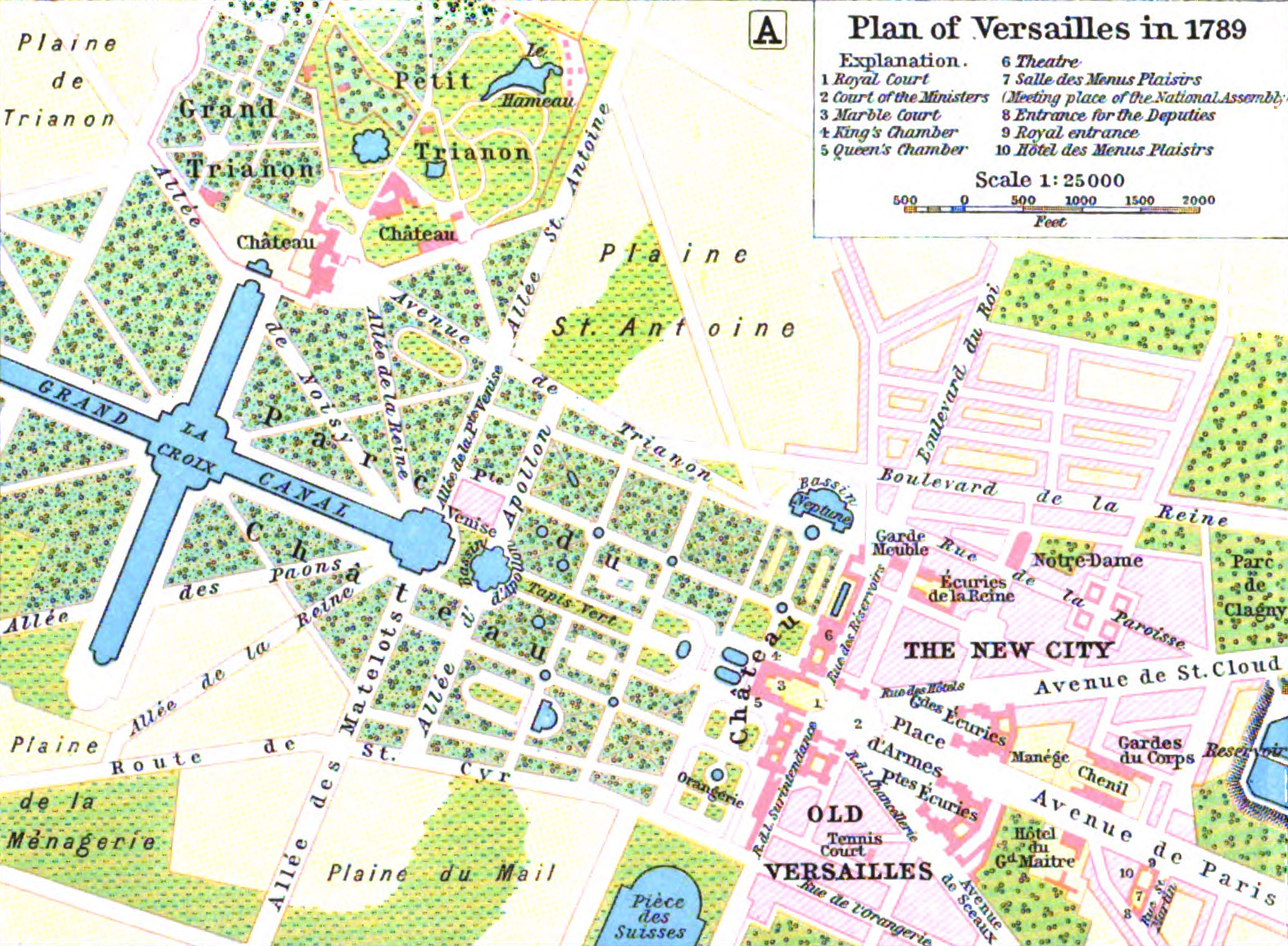
| William Robert Shepherd: Plan of Versailles in 1789
( |
|||||||||||||||||||||||
|---|---|---|---|---|---|---|---|---|---|---|---|---|---|---|---|---|---|---|---|---|---|---|---|
| Kënschtler |
|
||||||||||||||||||||||
| Titel |
Plan of Versailles in 1789 |
||||||||||||||||||||||
| Datum | 1911 | ||||||||||||||||||||||
| Dimensiounen | Héicht: 13,3 cm; Breet: 19,8 cm | ||||||||||||||||||||||
| Notizen |
|
||||||||||||||||||||||
| Quell/Fotograf |
|
||||||||||||||||||||||
.jpg)
Lizenz
|
Dies ist eine originalgetreue fotografische Reproduktion eines zweidimensionalen Kunstwerks. Das Kunstwerk an sich ist aus dem folgenden Grund gemeinfrei:
Nach offizieller Ansicht der Wikimedia Foundation sind originalgetreue Reproduktionen zweidimensionaler gemeinfreier Werke gemeinfrei. Diese fotografische Reproduktion wird daher auch als gemeinfrei in den Vereinigten Staaten angesehen. Die Verwendung dieser Werke kann in anderen Rechtssystemen verboten oder nur eingeschränkt erlaubt sein. Zu Details siehe Reuse of PD-Art photographs.
| ||||
Versiounen
Klickt op e bestëmmten Zäitpunkt fir déi respektiv Versioun vum Fichier ze kucken.
| Versioun vum | Miniaturbild | Dimensiounen | Benotzer | Bemierkung | |
|---|---|---|---|---|---|
| aktuell | 09:14, 5. Aug. 2015 | | 1.572 × 1.154 (864 KB) | Robert.Allen | from the HathiTrust copy of the book, better color, somewhat higher resolution |
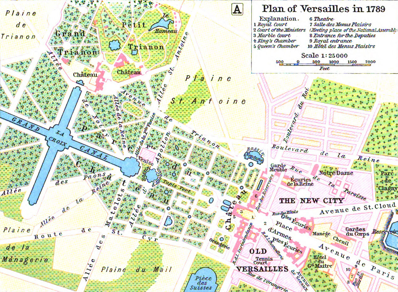
| 00:39, 5. Jul. 2005 |  | 771 × 579 (174 KB) | Kocio | A map of Versailles in 1789 from William R Shepherd's ''Historical Atlas''. (from: http://en.wikipedia.org/wiki/Map_of_Versailles_in_1789_by_William_R_Shepherd_(died_1934).jpg) {{PD}} |
Benotze vu Fichieren
Dës Säite benotzen dëse Fichier:
Globaalt Benotze vum Fichier
Dës aner Wikie benotzen dëse Fichier:
- Benotzt op ast.wikipedia.org
- Benotzt op azb.wikipedia.org
- Benotzt op az.wikipedia.org
- Benotzt op bg.wikipedia.org
- Benotzt op bs.wikipedia.org
- Benotzt op cs.wikipedia.org
- Benotzt op en.wikipedia.org
- Benotzt op es.wikipedia.org
- Benotzt op fi.wikipedia.org
- Benotzt op fr.wikipedia.org
- Benotzt op he.wikipedia.org
- Benotzt op hr.wikipedia.org
- Benotzt op hu.wikipedia.org
- Benotzt op it.wikipedia.org
- Benotzt op ja.wikipedia.org
- Benotzt op lt.wikipedia.org
- Benotzt op mk.wikipedia.org
- Benotzt op nl.wikipedia.org
- Benotzt op pl.wikipedia.org
- Benotzt op pt.wikipedia.org
- Benotzt op sh.wikipedia.org
- Benotzt op simple.wikipedia.org
- Benotzt op sr.wikipedia.org
- Benotzt op tr.wikipedia.org
- Benotzt op vi.wikipedia.org
- Benotzt op zh.wikipedia.org
.jpg)