
Fichier:Antarctica Map.png

Gréisst vun dëser Duerstellung: 488 × 600 Pixel. Aner Opléisungen: 195 × 240 Pixel | 502 × 617 Pixel.
Original-Fichier (502 × 617 Pixel, Fichiersgréisst: 52 KB, MIME-Typ: image/png)
- Deutsch: Karte der Antarktis
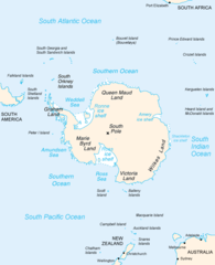
- English: Map of Antarctica
- Español: Mapa de la Antártida
- Polski: Mapa Antarktydy
- For a French version, see : Image:Antarctique_carte.png
- For an German version, see : Image:Antarctica_Karte.png
Dieses Werk ist gemeinfrei, weil es Bildmaterial aus dem CIA World Factbook darstellt, das ursprünglich vom Zentralen Nachrichtendienst der Vereinigten Staaten veröffentlicht wurde.
|
 |
derivative works
Derivative works of this file: Map-antarctica-ross-ice-shelf-red-x.png
Versiounen
Klickt op e bestëmmten Zäitpunkt fir déi respektiv Versioun vum Fichier ze kucken.
| Versioun vum | Miniaturbild | Dimensiounen | Benotzer | Bemierkung | |
|---|---|---|---|---|---|
| aktuell | 23:16, 15. Dez. 2004 | | 502 × 617 (52 KB) | Mschlindwein |
Benotze vu Fichieren
Et gëtt keng Säiten, déi dëse Fichier benotzen.
Globaalt Benotze vum Fichier
Dës aner Wikie benotzen dëse Fichier:
- Benotzt op an.wikipedia.org
- Benotzt op ar.wikipedia.org
- Benotzt op avk.wikipedia.org
- Benotzt op azb.wikipedia.org
- Benotzt op be.wikipedia.org
- Benotzt op bjn.wikipedia.org
- Benotzt op blk.wikipedia.org
- Benotzt op bn.wikipedia.org
- Benotzt op br.wikipedia.org
- Benotzt op bs.wikipedia.org
- Benotzt op ca.wikipedia.org
- Benotzt op cs.wikipedia.org
- Benotzt op da.wikipedia.org
- Benotzt op de.wikinews.org
- Benotzt op en.wikipedia.org
- Filchner–Ronne Ice Shelf
- Palmer Land
- Frost Glacier
- Second German Antarctic Expedition
- Totten Glacier
- Wikipedia:WikiProject Antarctica
- Polynesian navigation
- Underwood Glacier
- Farthest South
- Adams Glacier (Wilkes Land)
- Ocean fisheries
- 80th parallel south
- Southern Ocean
- Dibble Iceberg Tongue
- Gilchrist Glacier
- Peterson Glacier
- Bell Glacier
- Blair Glacier
- Blodgett Iceberg Tongue
- Bond Glacier
- Bibliography of Antarctica
- Conger Glacier
- Waldron Glacier
- Whittle Glacier
Kuckt globale Gebrauch vun dësem Fichier.