
Fichier:Map - NL - Municipality code 0983 (2009).svg

Gréisst vun dëser PNG-Duerstellung vun dësem SVG-Fichier: 300 × 160 Pixel. Aner Opléisungen: 320 × 171 Pixel | 640 × 341 Pixel | 1.024 × 546 Pixel | 1.280 × 683 Pixel | 2.560 × 1.365 Pixel.
Original-Fichier (SVG-Fichier, Basisgréisst: 300 × 160 Pixel, Gréisst vum Fichier: 531 KB)
| Beschreiwung |
|
|||
| Datum | ||||
| Quell | own work , using CBS data | |||
| Auteur | Michiel1972 (talk) 23:54, 24 January 2009 (UTC) | |||
| Autorisatioun (Dëse Fichier nach eng Kéier benotzen) |
Attribution ShareAlike 3.0 |

.svg)
Dëse Fichier ass ënner der Creative Commons Attribution-Share Alike 3.0 Unported Lizenz disponibel.
- Dir kënnt:
- D'Wierk deelen – kopéieren, verdeelen a weiderginn
- D'Wierk kombinéieren – adaptéieren
- Ënner dëse Konditiounen:
- Attributioun – Dir musst appropriéiert Informatiounen iwwer den Auteur uginn, e Link op d'Lizenz maachen, an uginn ob Ännerunge gemaach goufen. Dës Informatioune kënnen op eng räsonabel Manéier gi ginn, awer ouni datt den Androck entsteet datt deen deen d'Lizenz ginn huet Iech oder Är Benotzung approuvéiert oder ënnerstëtzt.
- ënner deselwechte Bedingunge weiderginn – Wann Dir dëst Wierk ännert, transforméiert oder dorop opbaut, dierft Dir dat Wierk, dat doraus entsteet, nëmmen ënner der selwechter oder enger kompatibeler Lizenz, verbreeden.
Versiounen
Klickt op e bestëmmten Zäitpunkt fir déi respektiv Versioun vum Fichier ze kucken.
| Versioun vum | Miniaturbild | Dimensiounen | Benotzer | Bemierkung | |
|---|---|---|---|---|---|
| aktuell | 21:22, 7. Okt. 2019 | | 300 × 160 (531 KB) | Thayts | Reverted to version as of 23:54, 24 January 2009 (UTC) - does not match name (2009) anymore |
| 08:50, 19. Dez. 2010 |  | 300 × 160 (39 KB) | Hannes Karnoefel | arcen en velden erbij | |
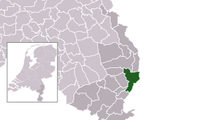
| 23:54, 24. Jan. 2009 |  | 300 × 160 (531 KB) | Michiel1972 | {{Information |Description=*Location maps for the 441 municipalities in the Netherlands. Boundaries 1/1/2009 *Automatically generated with script *File name contains "Municipality code" (CBS-code) as specified in: [http://www.cbs.nl/nl-NL/menu/methoden/c |
Benotze vu Fichieren
Dës Säit benotzt dëse Fichier:
Globaalt Benotze vum Fichier
Dës aner Wikie benotzen dëse Fichier:
- Benotzt op ar.wikipedia.org
- Benotzt op arz.wikipedia.org
- Benotzt op ca.wikipedia.org
- Benotzt op el.wikipedia.org
- Benotzt op en.wikipedia.org
- Benotzt op eo.wikipedia.org
- Benotzt op eu.wikipedia.org
- Benotzt op fa.wikipedia.org
- Benotzt op fr.wikipedia.org
- Benotzt op hy.wikipedia.org
- Benotzt op it.wikipedia.org
- Benotzt op ko.wikipedia.org
- Benotzt op la.wikipedia.org
- Benotzt op li.wikipedia.org
- Benotzt op mk.wikipedia.org
- Benotzt op nds-nl.wikipedia.org
- Benotzt op pt.wikipedia.org
- Benotzt op ru.wikipedia.org
- Benotzt op stq.wikipedia.org
- Benotzt op ur.wikipedia.org
- Benotzt op www.wikidata.org
.svg)