
Fichier:Luxembourg relief location map.jpg
Gréisst vun dëser Duerstellung: 433 × 599 Pixel. Aner Opléisungen: 173 × 240 Pixel | 347 × 480 Pixel | 829 × 1.147 Pixel.
Original-Fichier (829 × 1.147 Pixel, Fichiersgréisst: 481 KB, MIME-Typ: image/jpeg)
| Beschreiwung |
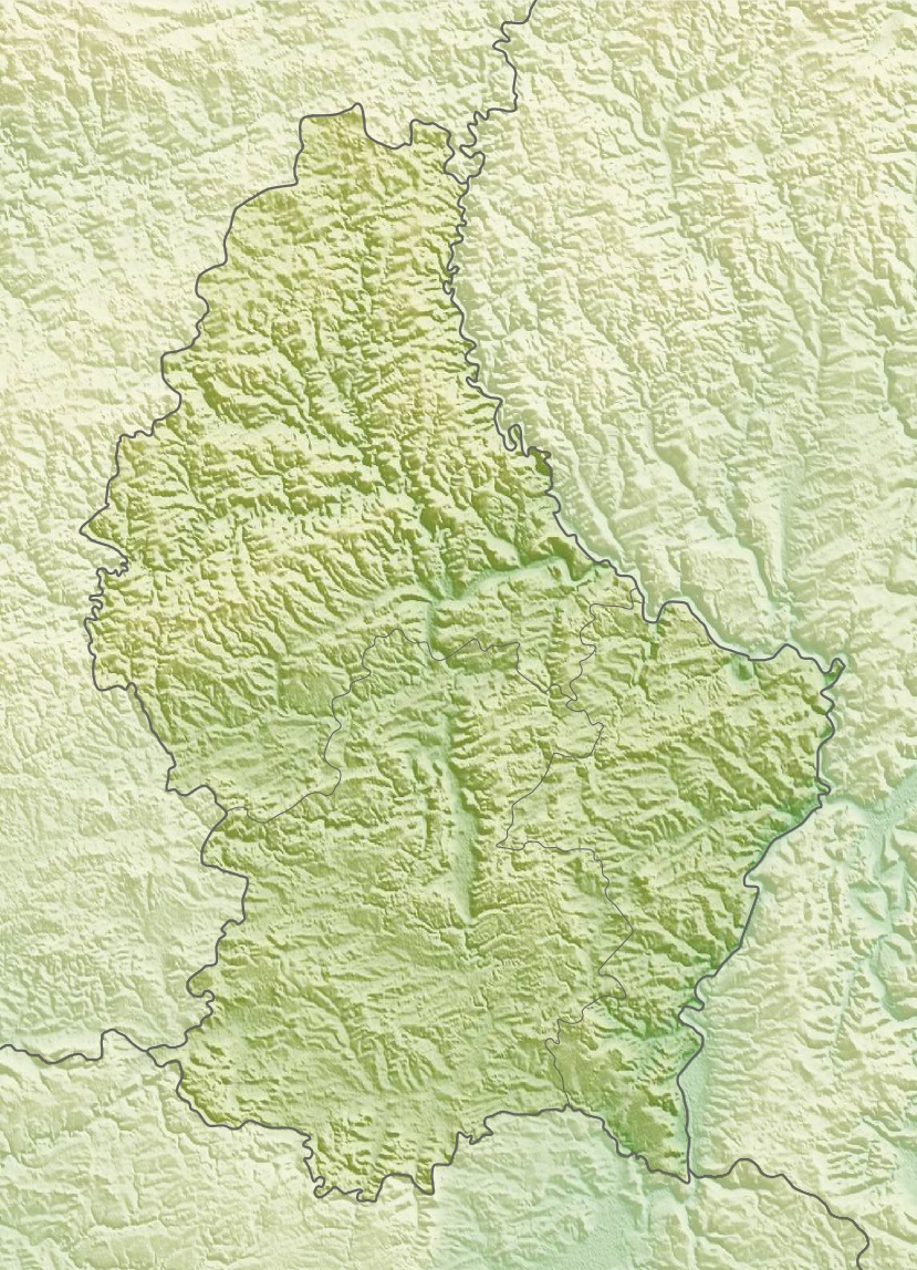
Deutsch: Physische Positionskarte von Luxemburg
Quadratische Plattkarte. Geographische Begrenzung der Karte:
English: Physical location map of Luxembourg
Equirectangular projection. Geographic limits of the map:
|
| Datum | |
| Quell | Eegent Wierk, using map data from administrative map by Lencer and SRMT3-data for the relief |
| Auteur | Carport |
| Autorisatioun (Dëse Fichier nach eng Kéier benotzen) |
Dëse Fichier ass ënner der Creative Commons Attribution-Share Alike 3.0 Unported Lizenz disponibel.
|
| Aner Versiounen |
|

Versiounen
Klickt op e bestëmmten Zäitpunkt fir déi respektiv Versioun vum Fichier ze kucken.
| Versioun vum | Miniaturbild | Dimensiounen | Benotzer | Bemierkung | |
|---|---|---|---|---|---|
| aktuell | 14:39, 10. Mäe. 2010 | | 829 × 1.147 (481 KB) | Carport | {{Information |Description={{de|Physische Positionskarte von {{w|Luxemburg|3=de}}}} Quadratische Plattkarte. Geographische Begrenzung der Karte: * N: 50.25° N * S: 49.4° N * W: 5.65° O * O: 6.6° O {{en|Physical location map of {{w|Luxembourg}}}} Equir |
Benotze vu Fichieren
Dës Säite benotzen dëse Fichier:
Globaalt Benotze vum Fichier
Dës aner Wikie benotzen dëse Fichier:
- Benotzt op ar.wikipedia.org
- Benotzt op ast.wikipedia.org
- Benotzt op az.wikipedia.org
- Benotzt op ba.wikipedia.org
- Benotzt op bn.wikipedia.org
- Benotzt op bs.wikipedia.org
- Benotzt op ca.wikipedia.org
- Benotzt op ceb.wikipedia.org
- Benotzt op ce.wikipedia.org
- Benotzt op ckb.wikipedia.org
- Benotzt op cs.wikipedia.org
- Benotzt op cv.wikipedia.org
- Benotzt op de.wikipedia.org
- Benotzt op de.wikivoyage.org
Kuckt globale Gebrauch vun dësem Fichier.