
Fichier:Ei-map.svg

Gréisst vun dëser PNG-Duerstellung vun dësem SVG-Fichier: 517 × 599 Pixel. Aner Opléisungen: 207 × 240 Pixel | 414 × 480 Pixel | 662 × 768 Pixel | 883 × 1.024 Pixel | 1.766 × 2.048 Pixel | 652 × 756 Pixel.
Original-Fichier (SVG-Fichier, Basisgréisst: 652 × 756 Pixel, Gréisst vum Fichier: 115 KB)
Resumé
| Beschreiwung |
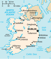
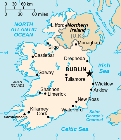
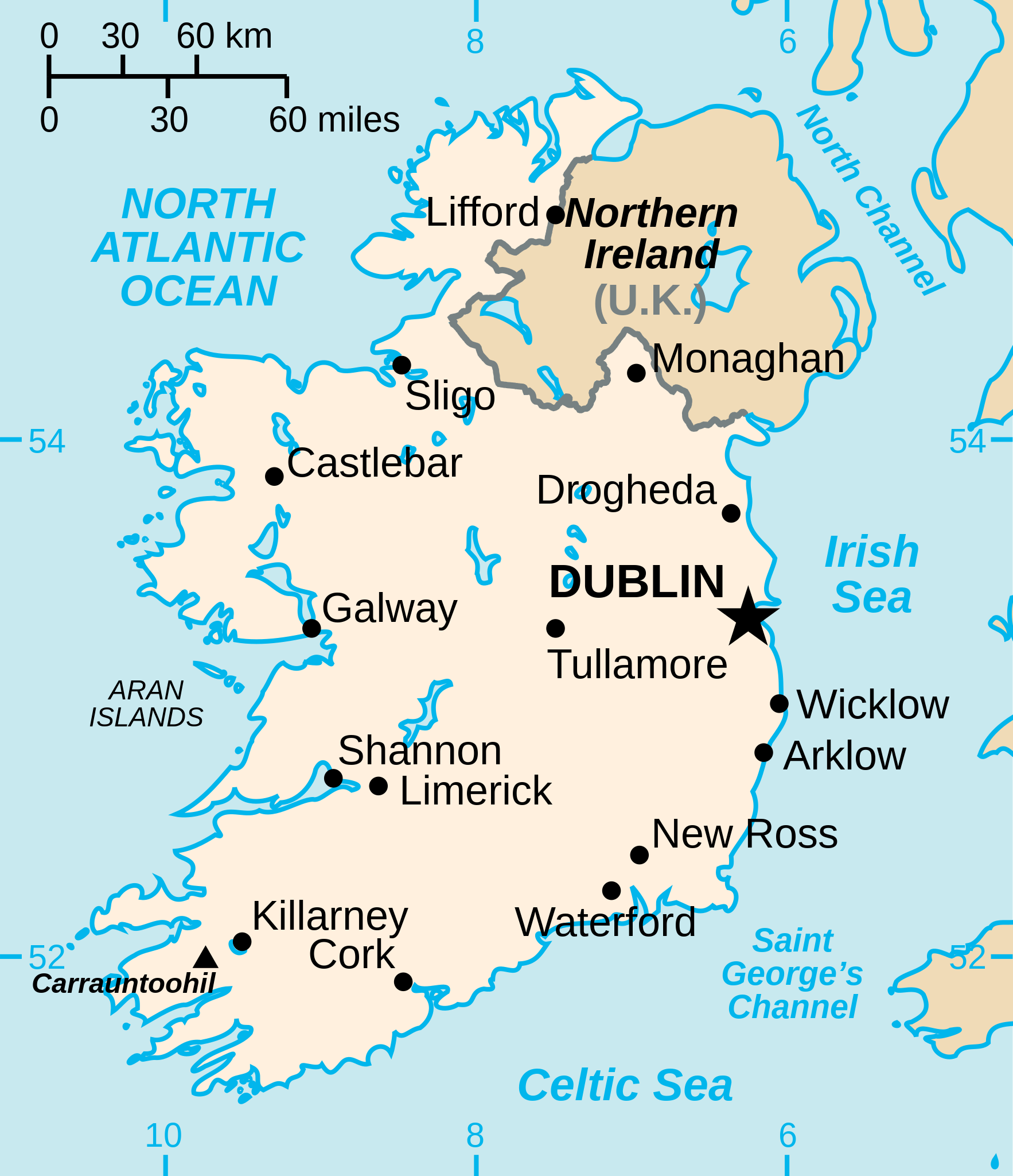
English: Vector version of CIA WorldBook map of the Republic of Ireland. Mercator projection. Vector information is from the CIA World DataBank II, and hence in the public domain. |
| Quell |
Diese Datei wurde von diesem Werk abgeleitet: Ei-map.png |
| Auteur | CIA World Factbook |
| Aner Versiounen |
[]
|


.svg)


Lizenz
| Ich, der Urheberrechtsinhaber dieses Werkes, veröffentliche es als gemeinfrei. Dies gilt weltweit. An eenzele Länner ass dat legal net méiglech; an deem Fall: Ech ginn heimat jiddwerengem d'Recht dëst Wierk fir all Zweck ze benotzen, ouni iergendeng Konditioun, ausser de Konditiounen déi vum Gesetz verlaangt sinn. |
Versiounen
Klickt op e bestëmmten Zäitpunkt fir déi respektiv Versioun vum Fichier ze kucken.
| Versioun vum | Miniaturbild | Dimensiounen | Benotzer | Bemierkung | |
|---|---|---|---|---|---|
| aktuell | 15:16, 24. Dez. 2022 | | 652 × 756 (115 KB) | Wikijahnn | File uploaded using svgtranslate tool (https://svgtranslate.toolforge.org/). Added translation for ca. |
| 19:34, 3. Sep. 2020 |  | 652 × 756 (110 KB) | Andrei Stroe | File uploaded using svgtranslate tool (https://svgtranslate.toolforge.org/). Added translation for ro. | |
| 22:16, 24. Jul. 2006 |  | 652 × 756 (99 KB) | Wereon | Vector version of CIA WorldBook map of the Republic of Ireland. Mercator projection. Vector information is from the CIA World DataBank II, and hence in the public domain. |
Benotze vu Fichieren
Dës Säit benotzt dëse Fichier:
Globaalt Benotze vum Fichier
Dës aner Wikie benotzen dëse Fichier:
- Benotzt op af.wikipedia.org
- Benotzt op af.wiktionary.org
- Benotzt op ang.wikipedia.org
- Benotzt op ar.wikipedia.org
- Benotzt op arz.wikipedia.org
- Benotzt op ast.wikipedia.org
- Benotzt op be-tarask.wikipedia.org
- Benotzt op be.wikipedia.org
- Benotzt op bg.wikipedia.org
- Benotzt op ca.wikipedia.org
- Benotzt op ceb.wikipedia.org
- Benotzt op cy.wikipedia.org
- Benotzt op da.wikipedia.org
- Benotzt op de.wikipedia.org
- Benotzt op de.wiktionary.org
- Benotzt op diq.wikipedia.org
- Benotzt op dsb.wikipedia.org
- Benotzt op dtp.wikipedia.org
- Benotzt op el.wikipedia.org
- Benotzt op en.wikipedia.org
Kuckt globale Gebrauch vun dësem Fichier.