
Fichier:Malta location map.svg

Gréisst vun dëser PNG-Duerstellung vun dësem SVG-Fichier: 645 × 600 Pixel. Aner Opléisungen: 258 × 240 Pixel | 516 × 480 Pixel | 826 × 768 Pixel | 1.101 × 1.024 Pixel | 2.202 × 2.048 Pixel | 773 × 719 Pixel.
Original-Fichier (SVG-Fichier, Basisgréisst: 773 × 719 Pixel, Gréisst vum Fichier: 141 KB)
Resumé
| Beschreiwung |
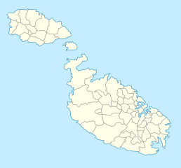
Deutsch: Positionskarte von Malta
Quadratische Plattkarte. Geographische Begrenzung der Karte:
English: Location map of Malta
Equirectangular projection. Geographic limits of the map:
|
||
| Datum | 5. September 2008 (Hochladedatum) | ||
| Quell | own work, using Fgura-map.svg by William Shewring | ||
| Auteur | Maximilian Dörrbecker (Chumwa) | ||
| Autorisatioun (Dëse Fichier nach eng Kéier benotzen) |
Ech, deen deen d'Auteursrechter vun dësem Wierk huet, verëffentlechen et heimat ënner dëse Lizenzen:
Dëse Fichier ass ënner der Creative Commons Attribution-Share Alike 3.0 Unported Lizenz disponibel.
Dir kënnt d'Lizenz vun Ärer Wiel eraussichen. |


|
Diese Karte wurde in der Kartenwerkstatt erstellt oder verbessert. Auch du kannst dort Karten vorschlagen, die zu erstellen, verändern oder übersetzen sind.
|
Versiounen
Klickt op e bestëmmten Zäitpunkt fir déi respektiv Versioun vum Fichier ze kucken.
| Versioun vum | Miniaturbild | Dimensiounen | Benotzer | Bemierkung | |
|---|---|---|---|---|---|
| aktuell | 04:57, 5. Sep. 2008 | | 773 × 719 (141 KB) | Chumwa | Karte etwas in N/S-Richtung gestreckt |
| 04:44, 5. Sep. 2008 |  | 773 × 565 (141 KB) | Chumwa | == Beschreibung == {{Information |Description= {{de|Positionskarte von Malta}} Quadratische Plattkarte. Geographische Begrenzung der Karte: * N: 36.06° N * S: 35.47° N * W: 14.10° O * O: 14.36° O {{en|Location map of Malta} |
Benotze vu Fichieren
Dës Säite benotzen dëse Fichier:
Globaalt Benotze vum Fichier
Dës aner Wikie benotzen dëse Fichier:
- Benotzt op af.wikipedia.org
- Benotzt op als.wikipedia.org
- Benotzt op an.wikipedia.org
- Benotzt op ar.wikipedia.org
- Benotzt op ast.wikipedia.org
- Benotzt op az.wikipedia.org
- Benotzt op ba.wikipedia.org
- Benotzt op be-tarask.wikipedia.org
Kuckt globale Gebrauch vun dësem Fichier.