
Fichier:Miranda2.JPG
Gréisst vun dëser Duerstellung: 659 × 600 Pixel. Aner Opléisungen: 264 × 240 Pixel | 527 × 480 Pixel | 844 × 768 Pixel | 1.201 × 1.093 Pixel.
Original-Fichier (1.201 × 1.093 Pixel, Fichiersgréisst: 144 KB, MIME-Typ: image/jpeg)
Resumé
| Beschreiwung |
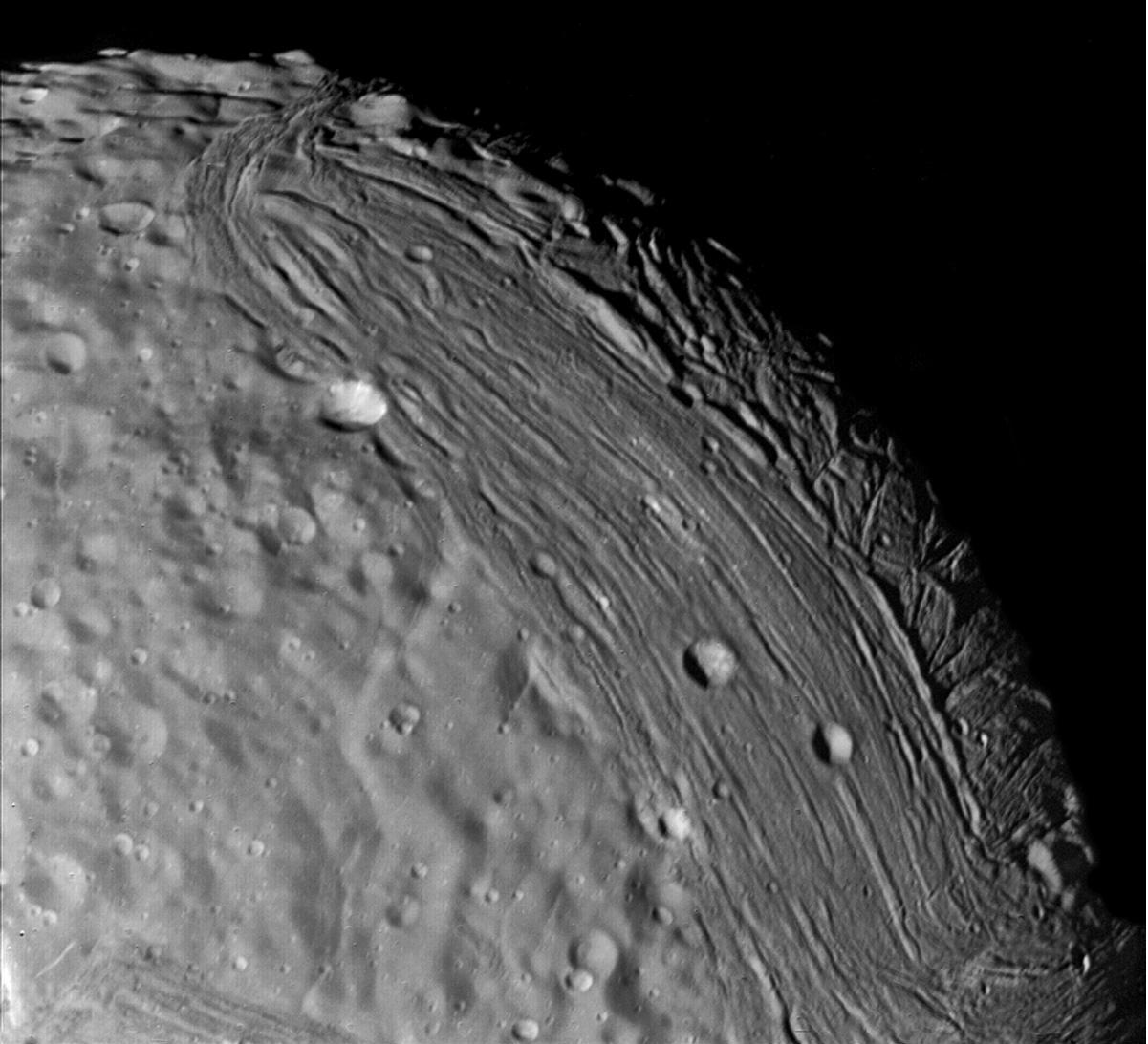
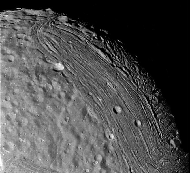
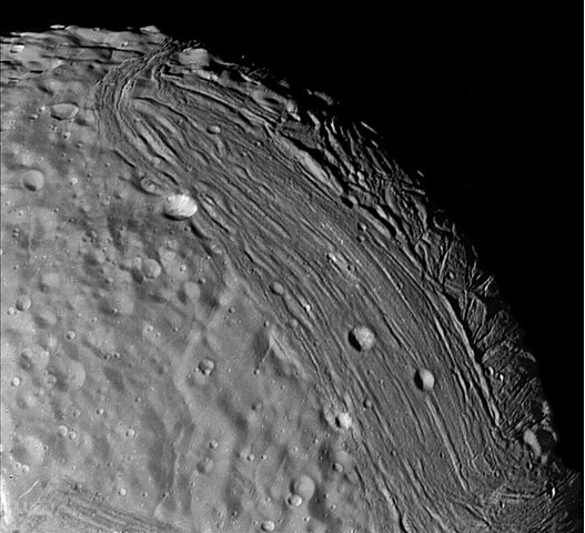
English: Miranda reveals a complex geologic history in this view, acquired by Voyager 2 on January 24, 1986, around its close approach to the Uranian moon. At least three terrain types of different age and geologic style are evident at this resolution of about 700 meters (2,300 feet). Visible in this clear-filter, narrow-angle image are, from left: (1) an apparently ancient, cratered terrain consisting of rolling, subdued hills and degraded medium-sized craters (2) a grooved terrain with linear valleys and ridges developed at the expense of, or replacing, the first terrain type: and (3) a complex terrain seen along the terminator, in which intersecting curvilinear ridges and troughs are abruptly truncated by the linear, grooved terrain. Voyager scientists believe this third terrain type is intermediate in age between the first two. |
|||||
| Datum | ||||||
| Quell | https://photojournal.jpl.nasa.gov/catalog/PIA00141 | |||||
| Auteur | NASA/JPL | |||||
| Autorisatioun (Dëse Fichier nach eng Kéier benotzen) |
|
Lizenz
| Diese Datei ist gemeinfrei (public domain), da sie von der NASA erstellt worden ist. Die NASA-Urheberrechtsrichtlinie besagt, dass „NASA-Material nicht durch Urheberrecht geschützt ist, wenn es nicht anders angegeben ist“. (NASA-Urheberrechtsrichtlinie-Seite oder JPL Image Use Policy). | ||
 |
Warnung:
|
Versiounen
Klickt op e bestëmmten Zäitpunkt fir déi respektiv Versioun vum Fichier ze kucken.
| Versioun vum | Miniaturbild | Dimensiounen | Benotzer | Bemierkung | |
|---|---|---|---|---|---|
| aktuell | 13:06, 26. Aug. 2006 | | 1.201 × 1.093 (144 KB) | Brallan~commonswiki | == Description == Miranda reveals a complex geologic history in this view, acquired by Voyager 2 on January 24, 1986, around its close approach to the Uranian moon. At least three terrain types of different age and geologic style are evident at this resol |
Benotze vu Fichieren
Dës Säit benotzt dëse Fichier:
Globaalt Benotze vum Fichier
Dës aner Wikie benotzen dëse Fichier:
- Benotzt op af.wikipedia.org
- Benotzt op ar.wikipedia.org
- Benotzt op ca.wikipedia.org
- Benotzt op de.wikipedia.org
- Benotzt op en.wikipedia.org
- Benotzt op eo.wikipedia.org
- Benotzt op fr.wikipedia.org
- Benotzt op hy.wikipedia.org
- Benotzt op id.wikipedia.org
- Benotzt op ms.wikipedia.org
- Benotzt op pl.wikipedia.org
- Benotzt op ro.wikipedia.org
- Benotzt op ru.wikipedia.org
- Benotzt op uk.wikipedia.org
- Benotzt op zh-yue.wikipedia.org
- Benotzt op zh.wikipedia.org