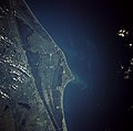
Fichier:Cape canaveral.jpg

Gréisst vun dëser Duerstellung: 606 × 600 Pixel. Aner Opléisungen: 242 × 240 Pixel | 485 × 480 Pixel | 776 × 768 Pixel | 1.035 × 1.024 Pixel | 2.069 × 2.048 Pixel | 5.320 × 5.266 Pixel.
Original-Fichier (5.320 × 5.266 Pixel, Fichiersgréisst: 7,79 MB, MIME-Typ: image/jpeg)
Versiounen
Klickt op e bestëmmten Zäitpunkt fir déi respektiv Versioun vum Fichier ze kucken.
| Versioun vum | Miniaturbild | Dimensiounen | Benotzer | Bemierkung | |
|---|---|---|---|---|---|
| aktuell | 19:35, 21. Mäe. 2009 |  | 5.320 × 5.266 (7,79 MB) | Jhf | Same image with greater resolution |
| 02:39, 18. Jun. 2005 |  | 504 × 633 (98 KB) | Charlitos~commonswiki | Cape Canaveral, Florida, USA - August 1991 from: http://en.wikipedia.org/wiki/Image:Cape_canaveral.jpg image description [http://eol.jsc.nasa.gov/sseop/EFS/photoinfo.pl?PHOTO=STS043-84-31 here] {{PD-USGov-NASA}} |
Benotze vu Fichieren
Dës Säit benotzt dëse Fichier:
Globaalt Benotze vum Fichier
Dës aner Wikie benotzen dëse Fichier:
- Benotzt op af.wikipedia.org
- Benotzt op ang.wikipedia.org
- Benotzt op ar.wikipedia.org
- Benotzt op ast.wikipedia.org
- Benotzt op az.wikipedia.org
- Benotzt op be.wikipedia.org
- Benotzt op bg.wikipedia.org
- Benotzt op bn.wikipedia.org
- Benotzt op bs.wikipedia.org
- Benotzt op ca.wikipedia.org
- Benotzt op ceb.wikipedia.org
- Benotzt op ckb.wikipedia.org
- Benotzt op cs.wikipedia.org
- Benotzt op da.wikipedia.org
- Benotzt op de.wikipedia.org
- Benotzt op de.wikinews.org
- Benotzt op de.wikivoyage.org
- Benotzt op el.wikipedia.org
- Benotzt op en.wikipedia.org
- Benotzt op en.wikiversity.org
- Benotzt op eo.wikipedia.org
- Benotzt op es.wikipedia.org
- Benotzt op et.wikipedia.org
- Benotzt op eu.wikipedia.org
- Benotzt op fa.wikipedia.org
- Benotzt op fi.wikipedia.org
- Benotzt op fr.wikipedia.org
- Benotzt op gl.wikipedia.org
- Benotzt op he.wikipedia.org
- Benotzt op he.wikivoyage.org
- Benotzt op hr.wikipedia.org
- Benotzt op hu.wikipedia.org
Kuckt globale Gebrauch vun dësem Fichier.
